
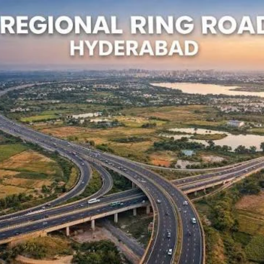
Quick answer: The Regional Ring Road Hyderabad (RRR) is a planned outer ring of about 362 km, roughly 40–60 km beyond the ORR, split into a 161.5 km northern section and a proposed 201 km southern section. As of October 2026, the north has its land acquisition reported complete and a central cost estimate of about ₹23,936 crore, but construction tenders are still not awarded. The south has only a state-approved alignment and no central approval, scheme or tender.
The two halves are at very different stages, and much of the confusion in the market comes from treating them as one project. This guide covers each section separately, then looks at what the road can and cannot do for land prices, and how to check the alignment before you pay for land near it.
Key facts at a glance
- Full name / ID: Regional Ring Road (RRR). The northern section is notified as part of NH 161AA (Sangareddy–Choutuppal).
- Total planned length: about 362.5 km (161.51 km north + about 201 km south), per a September 2026 news report.
- North section: Girmapur (Sangareddy district) to Thangadpalli (Yadadri-Bhuvanagiri district). Executing agency: NHAI, under Bharatmala Pariyojana Phase-I, Hybrid Annuity Model (HAM), six lanes.
- North cost: ₹23,935.6 crore, as stated by the Union Road Transport Minister in a July 2026 Rajya Sabha reply.
- North status (Oct 2026): land acquisition reported complete by the state R&B minister on 9 October 2026; bidding repeatedly postponed; earlier tender rounds reported cancelled; fresh tenders “soon”.
- South section: Choutuppal to Sangareddy via the Amangal side and the Future City area. State Cabinet approved the alignment in June 2025. MoRTH has not decided on it (September 2026).
- Land records to check: Bhu Bharati portal (replaced Dharani in 2025) and the gazette notifications under the National Highways Act.
What is the Regional Ring Road Hyderabad?
The RRR is meant to carry long-distance and freight traffic around Hyderabad without entering the Outer Ring Road (ORR). It links the radial national highways, including NH-65 (Vijayawada), NH-44 (Nagpur and Bengaluru), NH-163 (Warangal) and others, at points far outside the city. Think of it as a bypass for the bypass.
For property buyers, the important point is that it is two projects in practice:
| Item | Northern section | Southern section |
|---|---|---|
| Length | 161.51 km | about 201 km (proposed) |
| End points | Girmapur, Sangareddy to Thangadpalli, Choutuppal | Choutuppal to Sangareddy |
| Towns named on route | Sangareddy, Narsapur, Toopran, Gajwel, Jagdevpur, Bhongir, Choutuppal | Choutuppal, Amangal, Sangareddy; passes the Future City area |
| Districts | Sangareddy, Medak, Siddipet, Yadadri-Bhuvanagiri | Sangareddy, Vikarabad, Rangareddy, Mahbubnagar, Nagarkurnool, Nalgonda, Yadadri-Bhuvanagiri |
| Central scheme | Bharatmala Pariyojana Phase-I | None yet |
| Estimated cost | ₹23,935.6 crore (six-lane) | Not published |
| Land acquisition | Reported complete (Oct 2026) | Not started under NH Act |
| Tender | Not awarded; fresh tenders expected | None |
RRR northern section: status as of October 2026
The northern half is the one that is real in the legal and financial sense.
Approvals. MoRTH approved the northern stretch under Bharatmala Pariyojana Phase-I back in March 2021. The design was later scaled up from four lanes to six. In a Rajya Sabha reply reported on 30 July 2026, the Union minister said the DPR for the 161.518 km corridor was complete and had been appraised by the Public-Private Partnership Appraisal Committee (PPPAC), at an estimated capital cost of ₹23,935.6 crore. A Telangana Today report from 25 August 2026 said every clearance except the Cabinet Committee on Economic Affairs (CCEA) had been obtained.
Land acquisition. The same July 2026 reply said Section 3D notices (the final land notification under the National Highways Act) covered 99.06% of the required land, and compensation awards under Section 3G had been declared for 87.19%. On 9 October 2026, Telangana’s Roads and Buildings minister said land acquisition for the northern section is complete. The state shares 50% of the land cost and set aside ₹1,525 crore for it in the 2026–27 budget.
Tenders. NHAI invited six-lane HAM bids on 11 November 2025. The bid deadline was then extended several times through 2026 (to 6 July, 6 August, 20 August and 23 September). On 9 October 2026, the state minister said two earlier tender rounds had been cancelled because land acquisition was incomplete, and that fresh tenders would be invited soon, with the government aiming to finish tendering within two months.
What this means. The northern RRR is funded on paper and its land is acquired, but no contractor is on site. Even after an award, a 161 km greenfield highway takes years to build. No official completion date has been announced.
RRR southern section: status as of October 2026
The southern half is at a much earlier stage. Do not let anyone price southern land as if the road is coming next year.
- Alignment: A Cabinet sub-committee was formed in September 2024, a consultant was hired for the DPR in May 2025, and the State Cabinet approved the alignment in June 2025. There were farmer protests over the route.
- Sent to the Centre: The revised alignment went to MoRTH on 25 February 2026.
- Central decision: In September 2026, MoRTH told the state that no decision had been taken on the south alignment because the project is not covered by any central scheme. Telangana has asked for it to be added to Bharatmala or another scheme and built alongside the north.
- DPR and cost: The DPR was still being prepared as of July 2026, and no cost has been published.
- Land: About 2,010 hectares across 55 habitations would be needed, per the state’s submission. No NH Act acquisition has been notified.
Older route maps online show southern towns such as Ibrahimpatnam, Kandukur, Chevella and Shankarpally. Those came from earlier proposals. Treat any village list for the south as provisional until the Centre approves an alignment and issues gazette notifications.
Will the RRR raise land prices near it?
Honest answer: possibly, over a long time, and unevenly.
- Interchanges matter, not the road line. On an access-controlled road, land beside the carriageway gains little. Value tends to collect near exits and where the RRR crosses an existing highway. Exit locations are fixed in the DPR, not in a brochure.
- The north is ahead. Land in belts such as Bhongir, Choutuppal, Gajwel and Sangareddy sits near an alignment that is notified and acquired. Construction timing is still unknown.
- The south is a policy bet. Areas in the broad southern belt, including parts of Shadnagar and Vikarabad, depend on a central decision that has not been made. Buy there for reasons that hold even if the RRR is delayed: road access today, clear title, and a fair price.
- The ORR belt still leads. Most near-term demand sits closer in. Our guide to areas near the ORR expected to grow fastest covers that.
We do not quote RRR appreciation figures because no reliable data exists for a road that is not yet built.
How do I check if a plot is on or near the RRR alignment?
Before paying a token amount for any land “near the RRR”, run these checks:
- Get the survey number and village from the seller in writing.
- Search the gazette notifications. For the north, NHAI published Section 3A (intent) and 3D (final) notifications listing survey numbers village by village. If your survey number appears, part or all of it is being acquired by the government, not sold to you.
- Check Bhu Bharati. Look up the land record on the Bhu Bharati portal for the owner name, extent and any prohibitory marking.
- Ask the Tahsildar’s office whether the parcel is under NH acquisition or affected by a road widening.
- Measure the real distance to an interchange, not to the line on a map.
- Check layout approval if it is a plot. See HMDA plot vs gram panchayat plot for why this matters.
- For the south, ask for the source. If a seller says “RRR passes 1 km away”, ask which document shows it. A state-approved alignment is not a central approval.
FAQ
What is the RRR Hyderabad route?
The Regional Ring Road has two parts. The 161.5 km northern section runs from Sangareddy through Narsapur, Toopran, Gajwel, Jagdevpur and Bhongir to Choutuppal. The proposed 201 km southern section would run from Choutuppal to Sangareddy via the Amangal side and the Future City area. Only the northern alignment is notified under the National Highways Act.
What is the current status of the Regional Ring Road Hyderabad?
As of October 2026, the northern section’s land acquisition is reported complete and its cost is estimated at about ₹23,936 crore, but construction tenders have not been awarded and fresh tenders are expected. The southern section has state approval for its alignment but no central decision, scheme, cost or tender.
How long is the Regional Ring Road?
About 362.5 km in total, according to September 2026 reports: 161.51 km in the north and about 201 km in the south. Older sources quote 340 km or 346 km because earlier southern routes were shorter. The southern length can still change until the Centre approves an alignment.
When will the RRR be completed?
No official completion date has been announced for either section. The northern section still needs a contractor, and a highway of this length takes several years to build after award. The southern section has not been approved by the Centre, so any completion date quoted for it is speculation.
Is it a good idea to buy land near the RRR?
It can be, if the land makes sense on its own: clear title, good current road access and a fair price. The northern section is more certain than the southern. Avoid paying a premium based only on a future road, and check that your survey number is not being acquired for the highway.
How can I check if my land is in the RRR acquisition list?
Ask the seller for the survey number and village, then compare it with the NHAI land acquisition gazette notifications (Section 3A and 3D) for the northern section. Also check the record on the Bhu Bharati portal and confirm with the local Tahsildar’s office. For the south, no NH Act notification exists yet.
Browse land along the RRR belts
If you are tracking the RRR, look at land on its merits first and treat the road as a bonus. You can browse verified listings in Bhongir, Shadnagar and Vikarabad on Broker Network, and ask the listing broker for the survey number so you can run the checks above before you commit.